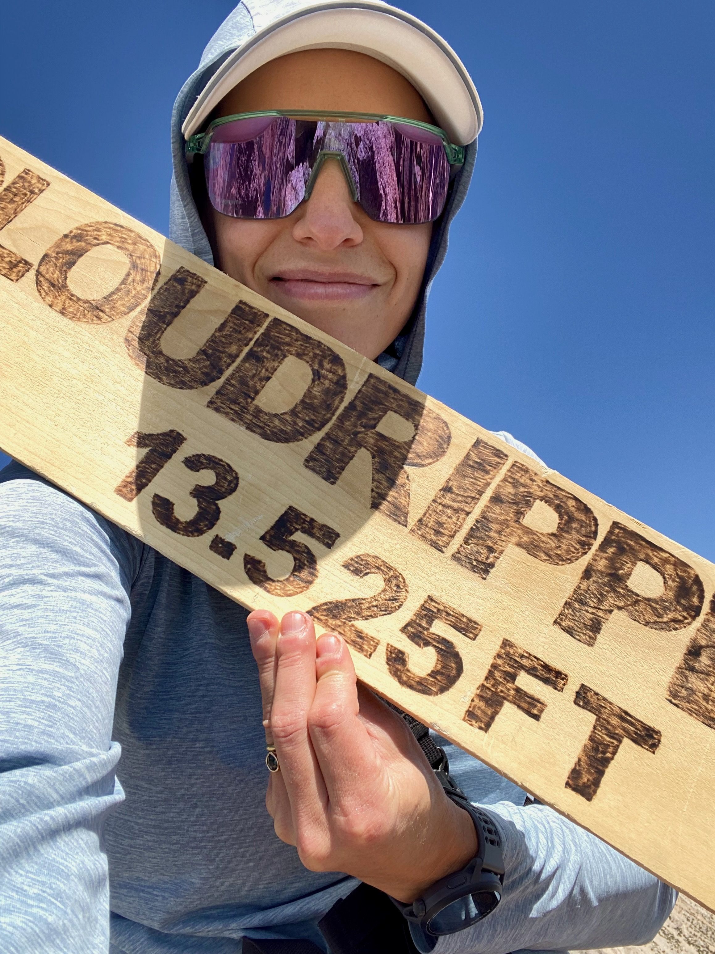
Cloudripper
At 13,525 feet, she's the highest peak in the Inconsolable Range, which is a subrange of the mighty Palisades. It's a peak I have traversed under countless times on my way up from South Lake towards Bishop pass, and yesterday I finally nabbed the summit.
I was yearning for a slog, the mountain provided. But not without some delightful surprises. I start up towards Green Lakes, taking a locals secret path along an old pipeline to skip some dusty switchbacks. Compared to the bustling trails to Treasure Lakes and Bishop Pass, this is a quiet area and I only encountered two different parties during my entire hike.
The hike is steep until you gain an unassuming basin, skirting the aptly named Brown and Green lakes. I'm sure during mosquito season this place is hell but being late summer, there were no bugs, just a hot breeze. My sun hoodie feels like armor.
After Green lake, a harsh grade quickly leads out of the basin onto the wide Coyote Ridge. Looking back the view frames Mount Tom, the patriarch of the Owens Valley (and still on my ticklist). This ridge is begging for a Western.
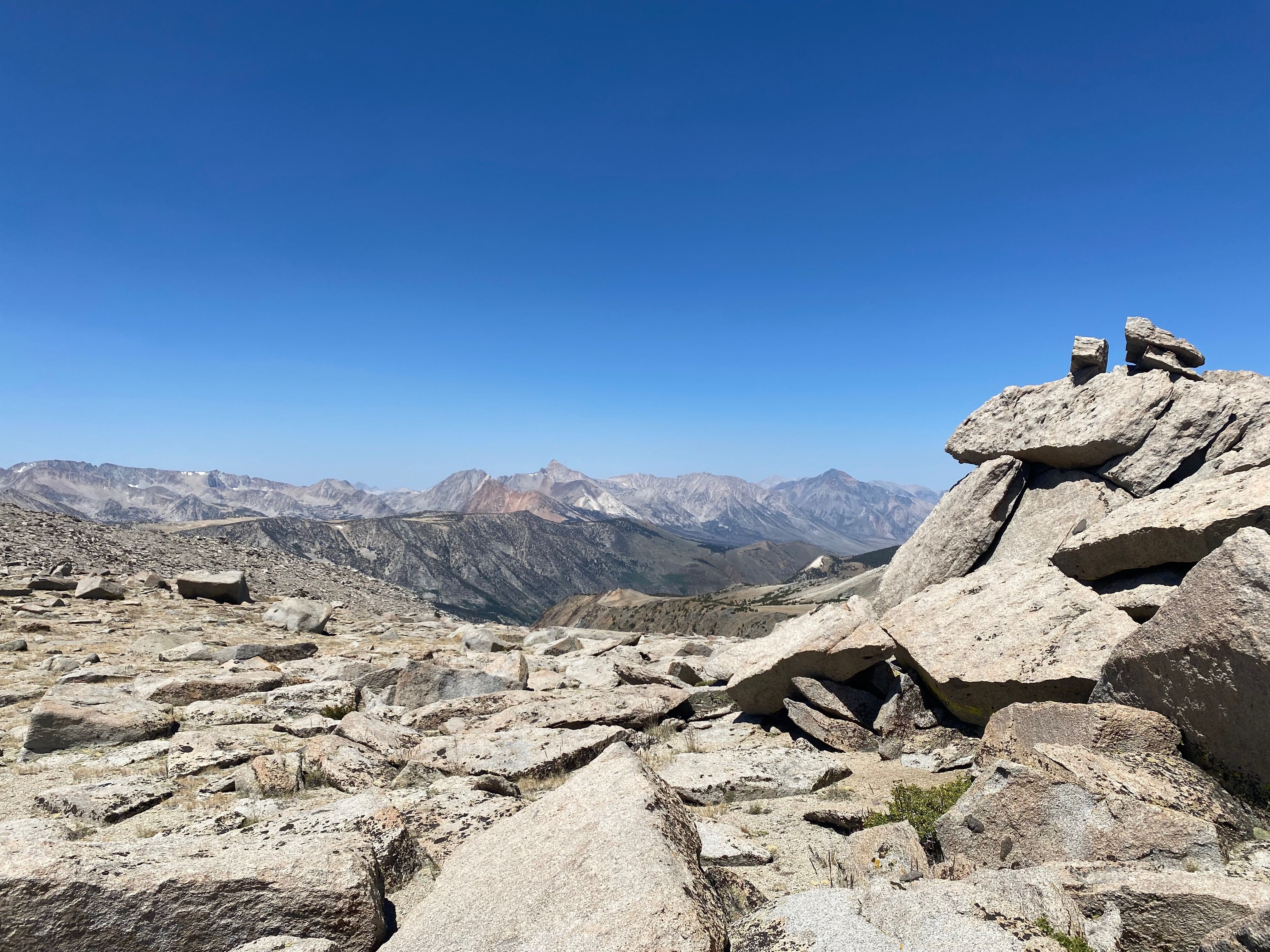
Up and to the right I see the next ridge to gain and beyond it, Vagabond peak, which is a subpeak I'll need to practically summit on the way to Cloudripper. I leave the trail when it feels right and start my way cross-country over large grained sand and rock clusters. Slowly the talus arrives and although tiring, its satisfying going hand over foot to promptly gain elevation. Route finding becomes paramount here, without sight of Cloudripper and steep gullied cliffs on either side of Vagabond, I wind my way just to the right of Vagabond summit.
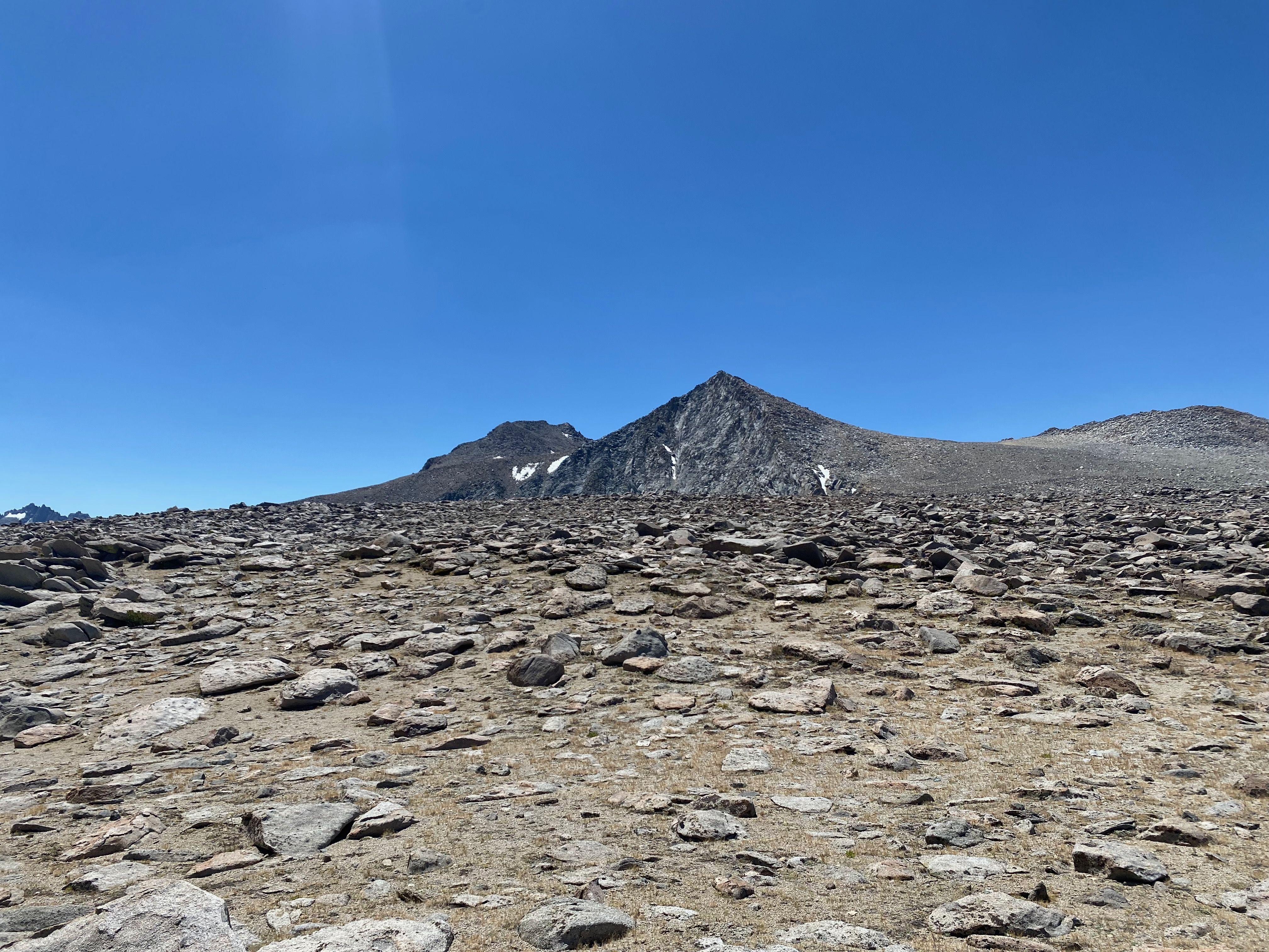
Through large boulders I catch glimpses of the exposure, the sun blazing, air cooling as I ascend, a quiet focus dampens fluttering excitement — its this feeling that keeps me seeking these peaks. After much effort, I finally atop Vagabonds shoulder and take a seat on this false summit to examine the rest of my climb. A party of four glissades down the sandy northern flank of the peak and are then swallowed by a steep gully dropping straight down. I mark this gully in my map as a potential descent option. Decisions, decisions, this northern flank seems to have numerous routes to a rocky summit. I ate an apple and chose the right-most ascent which appeared to be the steepest but with the most solid rock.
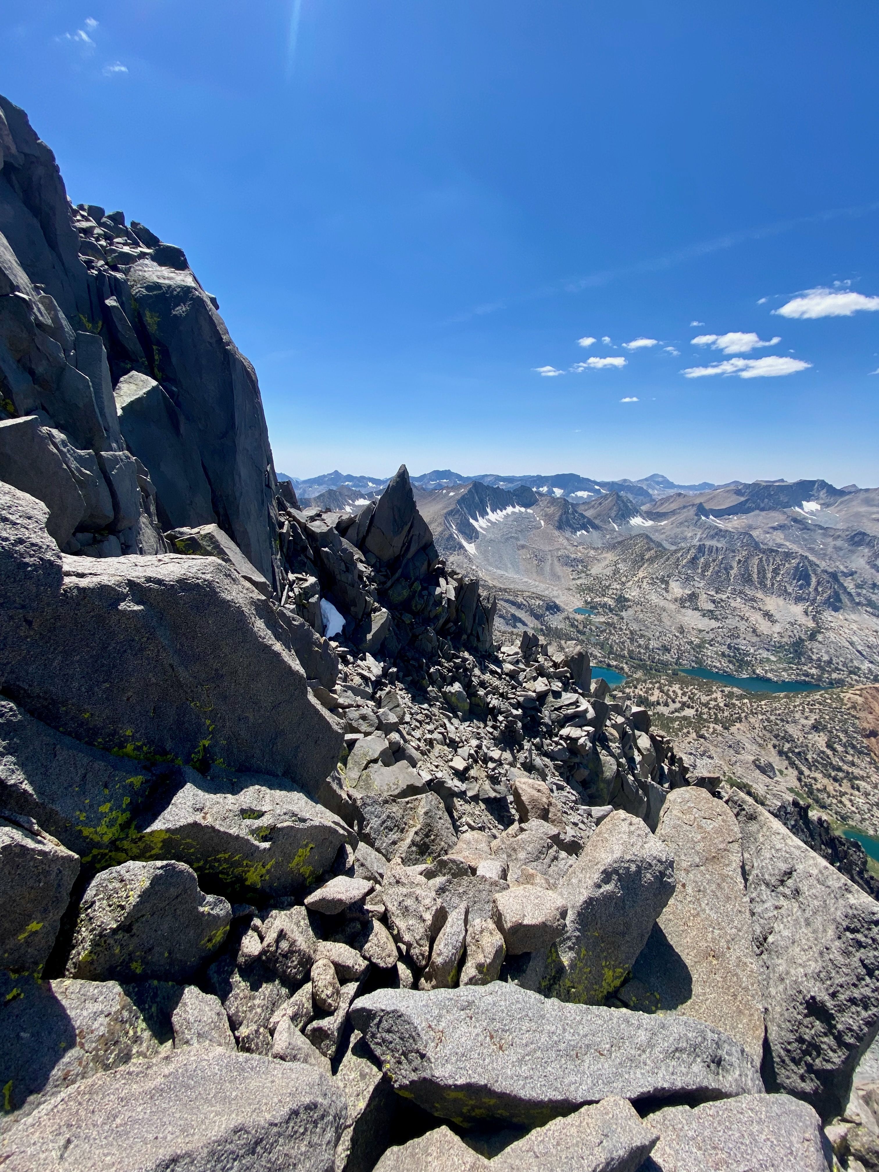
Its painful to descend when en route summiting a peak. Not necessarily physical, but the soul crushing pain of losing elevation when you're already at 13,000 feet and still have the final ascent ahead warrants a unique flavor of "god dammit". But it goes quickly and the last few hundred feet of gain shift to solid scrambling with eye-catching glimpses into the class 4-5 gullies on the west side.
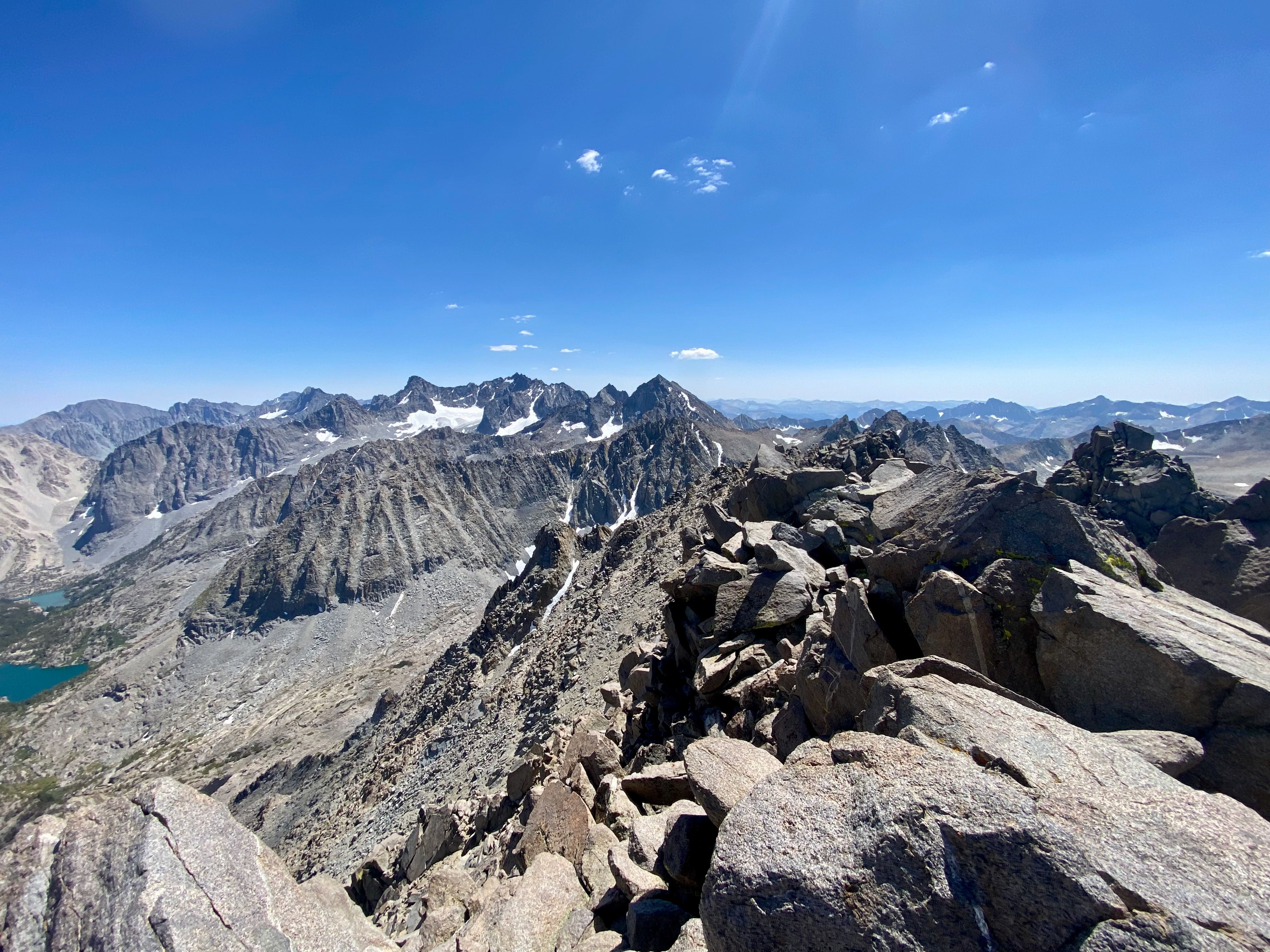
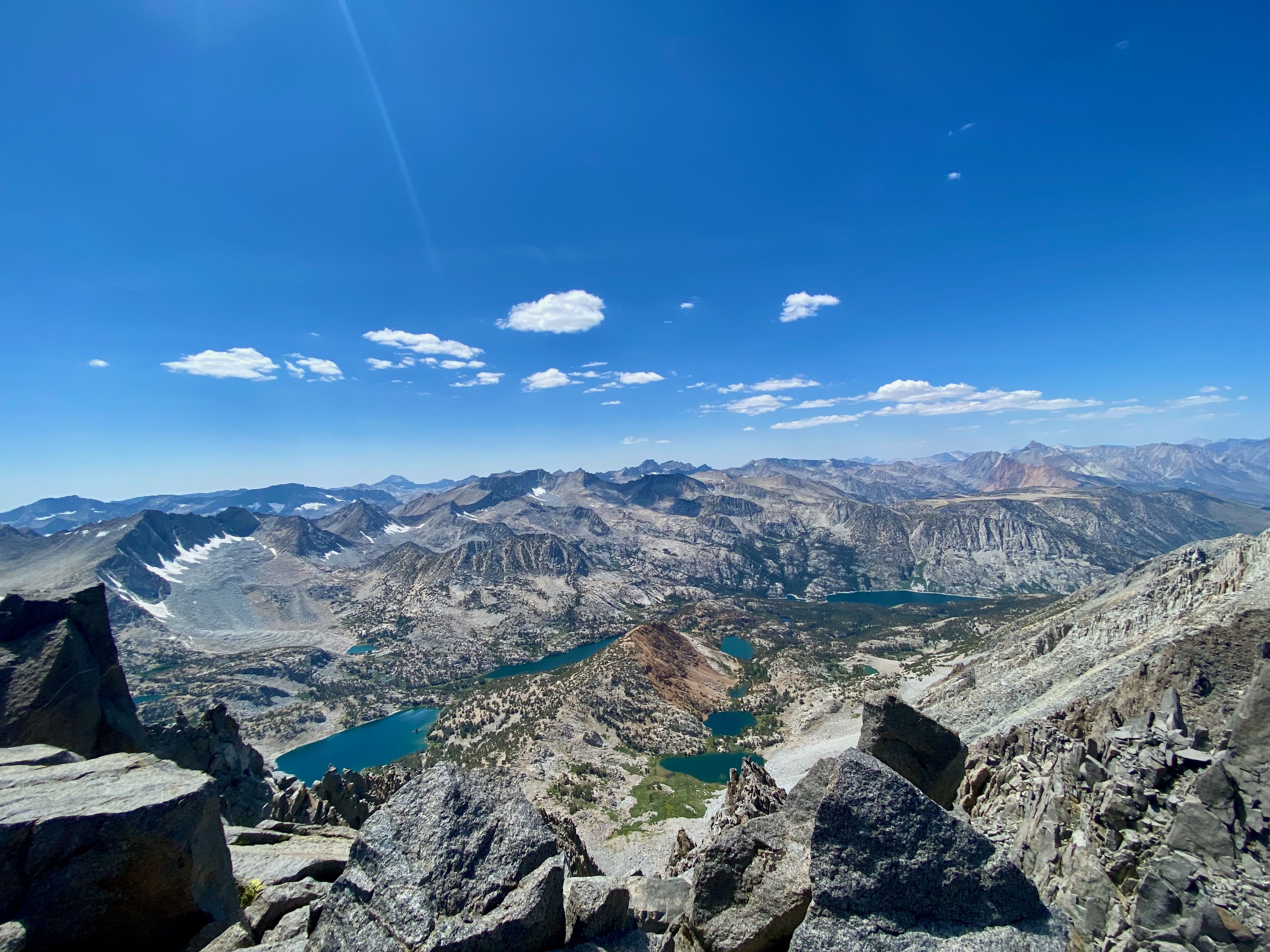
Near the summit, there's a few class 3 moves on solid rock. I choose my hand and foot placements carefully, with an elevated fuzz on my brain. And finally, the proper summit block, a clear high point towering over western chutes. The chocolate lakes basin glimmers below in an idyllic, pastoral scene. To the east, the Big Pine lakes spread beneath the rugged Palisades. In the far northwest, Humphreys and Mount Tom loom, at its wide base spreads a gradient from deep purple to camel into the Owens Valley. Not a breath of wind and a few tissue-like clouds, I take my time on this glorious peak, soaking in the deep quiet, the gift for those who climb mountains.
- ← Previous
40 mile run through the desert - Next →
The John Muir Trail